
Historic Central Avenue
Older cottages, bungalows, ranches, small multifamily buildings, and local storefronts.
Daily-life advantage: A traditional street grid near dining and events, with rail, flood, and older-system context.
Historic streets, newer hillside subdivisions, I-44 access, and outdoor destinations along the Meramec River landscape.
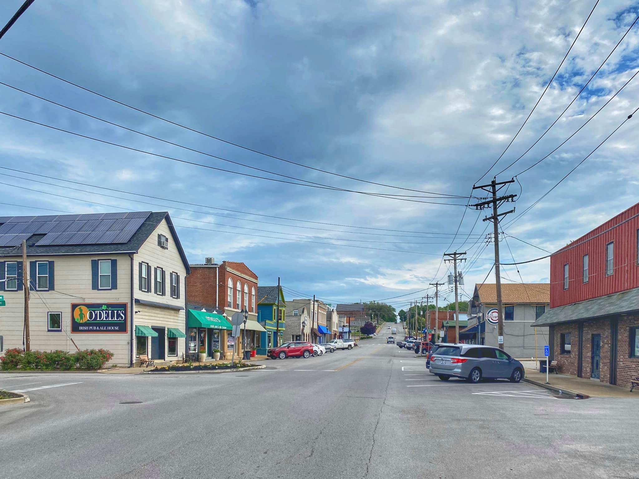
Central Avenue in historic Eureka · Wikimedia Commons

Eureka feels different from most of St. Louis County because I-44, the Meramec River, steep wooded terrain, historic Central Avenue, newer subdivisions, and major visitor destinations all meet in one place. Housing includes older cottages and ranches near the central grid, large subdivision two-stories, golf-course homes, new construction, and custom or acreage properties toward the edges. Rockwood serves the area, but assigned schools still need address-level confirmation. Buyers should review flood mapping and elevation, drainage on hillside lots, HOA rules, municipal permits and occupancy requirements, rail and Six Flags activity, and the actual eastbound I-44 commute during the hours they will use it.
A southwest-county city on I-44 at the edge of the Ozark landscape, with a historic core and newer subdivisions. Older town housing, large subdivisions, newer construction, wooded lots, and rural edges.
Primary regional access is through I-44, Route 109, and Highway W. Downtown St. Louis is roughly 30–45 minutes; peak traffic and the first miles on local roads can change the practical trip.
I-44 is the dominant regional route Hills, drainage, commute distance, HOAs, and school boundaries vary by subdivision
Older cottages, bungalows, ranches, small multifamily buildings, and local storefronts.
Daily-life advantage: A traditional street grid near dining and events, with rail, flood, and older-system context.
Large subdivisions, two-stories, ranches, golf-course homes, newer builds, pools, and sidewalks.
Daily-life advantage: Modern housing and direct access to I-44 and Wildwood routes.
Wooded lots, custom homes, rural-transition property, visitor-oriented uses, and varied utilities.
Daily-life advantage: Outdoor and highway access with more property-specific terrain, road, and service questions.
A rugged county park with hiking, mountain biking, equestrian trails, camping, and scheduled activities. Check trail conditions.
A regional amusement and water-park destination with seasonal operations, changing rides, events, admission, and parking policies.
Local restaurants, shops, markets, and community events line the older commercial center. Check the current calendar.
School attendance, emergency-response district, utility territory, and jurisdiction may vary within a mailing area. Confirm the organizations serving a specific property by address.
Low-lying parts of the Eureka area have experienced significant flooding; city name alone does not indicate risk.
What to do: Review current FEMA maps, elevation, access routes, prior claims, drainage, lender requirements, and insurance quotes.
Walkouts, retaining walls, rock, swales, and concentrated runoff are common on rolling sites.
What to do: Inspect after rain when possible and review grading, easements, sump discharge, walls, and repair history.
Six Flags traffic, community events, and active rail crossings can affect certain corridors.
What to do: Visit during representative periods and evaluate sound, access, parking, and alternate routes.
Permits, occupancy procedures, and inspections can change by transaction and intended use.
What to do: Confirm current city requirements and open permits early in the contract period.
Not necessarily. Postal names can extend beyond city limits, so city and county responsibilities may differ by parcel.
Use roughly 30–45 minutes as a general orientation. The exact starting point, destination, traffic, and local-road portion determine the actual trip.
Rockwood. Attendance boundaries can split a mailing area, so the property address controls the assignment.
Older town housing, large subdivisions, newer construction, wooded lots, and rural edges.
I-44 is the dominant regional route Hills, drainage, commute distance, HOAs, and school boundaries vary by subdivision
Start with the question you have today. No pressure and no generic sales pitch.