Community Guide · St. Charles County

Wentzville, Missouri

Rapid residential and commercial growth at the junction of I-70, I-64, and US 61, anchored by manufacturing and regional services.

Kyle Weiss
Kyle’s Local Take

Wentzville’s location at I-70, I-64, and US 61 has driven major residential, retail, school, and employment growth. The General Motors assembly complex remains a major industrial anchor, while Wentzville Parkway and newer corridors serve expanding subdivisions and daily needs. The housing mix now spans the historic rail-town grid, established ranches, large master-planned neighborhoods, townhomes, apartments, active builder phases, and rural edges. That growth creates opportunity and practical tradeoffs: traffic, construction, school attendance changes, HOA rules, special districts, drainage, and future land use need to be checked against the exact address.

Wentzville at a glance

A practical orientation before comparing properties

COMMUNITY TYPEIncorporated city · western St. Charles County growth center
2020 CENSUS POPULATION44,372
MEDIAN HOUSEHOLD INCOMESee current Census profile
MEDIAN OWNER-OCCUPIED VALUESee current Census profile
LAND AREAAbout 20.7 square miles
GENERAL TRAVEL TO DOWNTOWN ST. LOUIS40–60 minutes via I-70 or I-64 · estimated
Community character, housing, and commute

What daily life and property ownership look like here

A rapidly growing western-county city at the junction of I-70, I-64, and US 61. Historic town housing, large new subdivisions, apartments, townhomes, and edge acreage.

Primary regional access is through I-70, I-64/US 40, and US 61. Downtown St. Louis is roughly 45–60 minutes; peak traffic and the first miles on local roads can change the practical trip.

Fast growth creates construction, traffic, and changing adjacent land use HOAs, special districts, school capacity, and development plans deserve review

Neighborhood pockets

Wentzville changes noticeably from one corridor to another

Wentzville Parkway · Peine Road · Schroeder Creek · Timber Trace area

Wentzville Parkway growth corridor

Large planned neighborhoods, new and recent construction, apartments, townhomes, and retail-adjacent housing.

Daily-life advantage: Immediate everyday services and I-70 access, balanced against construction and peak commercial traffic.

Main Street · Linn Avenue · Allen Street · Railroad area

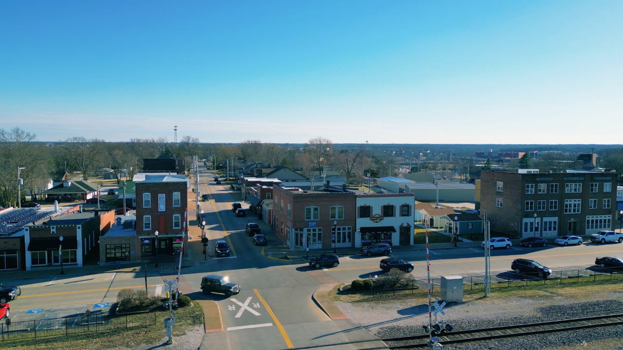
Historic downtown and rail grid

Older cottages, ranches, small lots, local businesses, and infill near the original city center.

Daily-life advantage: A traditional street grid and local destinations with rail and event activity to evaluate.

Highway Z · Interstate Drive · Perry Cate area

Highway Z and southern expansion

Newer subdivisions, executive homes, schools, construction phases, and rural-transition parcels.

Daily-life advantage: Access to I-64 and western-county destinations with changing adjacent development.

Things to do and everyday life

Local places around Wentzville

100 William Dierberg Drive

Heartland Park

A large city park with sports fields, a lake, boardwalk, trail, and inclusive playground. Check field schedules and event notices.

910 Main Plaza Drive

Wentzville Ice Arena

A city ice facility offering public skating, hockey, lessons, camps, and scheduled programs. Confirm the current calendar and admission.

Main Street area

Historic Downtown Wentzville

Local restaurants, shops, civic events, and railroad-era streets provide a different experience from the Parkway retail corridor.

Local services and institutions

Who serves Wentzville

MUNICIPAL GOVERNMENT

City of Wentzville

  • City Hall · 1001 Schroeder Creek Boulevard · 636-327-5101
  • Administration, police, planning, permits, parks, utilities, and municipal court
PUBLIC SCHOOLS

Wentzville School District

  • District office: 636-327-3800
  • Multiple elementary, middle, and high-school attendance areas
  • Confirm current and adopted future boundaries from the exact address
POLICE, FIRE & EMS

City and district services

  • Wentzville Police: 636-327-5105
  • Wentzville Fire Protection District
  • St. Charles County Ambulance District: 636-344-7600
UTILITIES

City and regional providers

  • Ameren Missouri or Cuivre River Electric
  • Spire where available
  • City or PWSD water may apply
  • City wastewater or another district may apply
EMPLOYMENT & GROWTH

Manufacturing and regional commerce

  • General Motors assembly operations
  • Wentzville Parkway retail and services
  • Construction, logistics, suppliers, and approved development
CONNECTIVITY

I-70, I-64, and US 61

  • Major highways meet in Wentzville
  • Route A and Highway Z serve local and rural connections
  • Traffic varies by interchange and shift schedule

School attendance, emergency-response district, utility territory, and jurisdiction may vary within a mailing area. Confirm the organizations serving a specific property by address.

Buyer due diligence

Four Wentzville details worth resolving before closing

Wentzville Parkway traffic

Retail and interchange traffic can create predictable queues during commutes and holiday shopping periods.

What to do: Test the actual route during peak conditions and identify realistic alternates.

School attendance changes

Rapid enrollment and new campuses can lead to boundary adjustments over time.

What to do: Confirm current attendance and ask the district about adopted future changes for the exact address.

Manufacturing and logistics activity

Shift changes, freight, suppliers, and industrial routes affect parts of the city.

What to do: Visit relevant neighborhoods during shift-change periods and review nearby zoning and development.

HOA, special districts, and construction phase

Newer communities may carry covenants, assessments, special taxes, unfinished amenities, builder control, or adjacent phases.

What to do: Review recorded documents, budgets, reserves, tax bills, plats, completion obligations, and current approvals.

Related communities

Compare other places in St. Charles County

Common questions

Wentzville questions buyers commonly ask

Is every Wentzville mailing address inside the same jurisdiction?

Not necessarily. Postal names can extend beyond city limits, so city and county responsibilities may differ by parcel.

How long is the drive to downtown St. Louis?

Use roughly 45–60 minutes as a general orientation. The exact starting point, destination, traffic, and local-road portion determine the actual trip.

Which school district serves the area?

Wentzville R-IV. Attendance boundaries can split a mailing area, so the property address controls the assignment.

What housing is common?

Historic town housing, large new subdivisions, apartments, townhomes, and edge acreage.

What local tradeoffs matter most?

Fast growth creates construction, traffic, and changing adjacent land use HOAs, special districts, school capacity, and development plans deserve review

References
City of Wentzville, MissouriU.S. Census Bureau data for Wentzville, MissouriWentzville School DistrictCity of Wentzville parks and recreationGeneral Motors Wentzville AssemblySt. Charles County governmentSt. Charles County governmentU.S. Census BureauRegional visitor and local-business directoryMissouri DESE directoryFCC National Broadband Map
Talk to Kyle

Thinking about making a move?

Start with the question you have today. No pressure and no generic sales pitch.

Prefer to talk now?