Community Guide · St. Charles County

O’Fallon, Missouri

A large, varied suburban city spanning the I-70 and Route 364 corridors, with extensive housing, employment, retail, and recreation.

Kyle Weiss
Kyle’s Local Take

O’Fallon is St. Charles County’s largest city, and it is too broad to treat as one uniform market. The I-70 side, historic core, Highway K corridor, WingHaven area, and southern Route 364 neighborhoods each have different housing eras, traffic patterns, schools, utilities, and daily destinations. Buyers can compare older ranches, large planned subdivisions, townhomes, villas, apartments, and new construction, with major employment and retail close by. The key is address-level diligence: verify the school district, HOA, special tax district, utilities, occupancy or rental requirements, drainage, remaining development, and the commute from the actual subdivision.

O’Fallon at a glance

A practical orientation before comparing properties

COMMUNITY TYPEIncorporated city · St. Charles County’s largest municipality
2020 CENSUS POPULATION91,316
MEDIAN HOUSEHOLD INCOMESee current Census profile
MEDIAN OWNER-OCCUPIED VALUESee current Census profile
LAND AREAAbout 29.8 square miles
GENERAL TRAVEL TO DOWNTOWN ST. LOUIS35–50 minutes via I-70 or Route 364 · estimated
Community character, housing, and commute

What daily life and property ownership look like here

St. Charles County’s largest city, spanning major I-70 and Route 364 suburban corridors. Large subdivisions, townhomes, apartments, established neighborhoods, and extensive new construction.

Primary regional access is through I-70, Route 364, Bryan Road, and Highway K. Downtown St. Louis is roughly 35–50 minutes; peak traffic and the first miles on local roads can change the practical trip.

The city is large enough that commute and daily life vary sharply by side HOAs, special districts, school boundaries, and construction phase differ by address

Neighborhood pockets

O’Fallon changes noticeably from one corridor to another

WingHaven Boulevard · Phoenix Parkway · Route 364 corridor

WingHaven and southern O’Fallon

Planned neighborhoods, executive homes, townhomes, apartments, golf-area housing, offices, and mixed-use services.

Daily-life advantage: Route 364 access and nearby employment, dining, healthcare, and neighborhood amenities.

Highway K · Turtle Creek · Laura Hill Road · Feise Road

Highway K corridor

Large established and newer subdivisions, two-stories, ranches, villas, and commercial-adjacent pockets.

Daily-life advantage: Dense everyday retail and services, balanced against peak traffic.

Main Street · Tom Ginnever Avenue · TR Hughes Boulevard

Historic core and I-70 side

Older ranches, cottages, established neighborhoods, civic property, recreation, and newer infill.

Daily-life advantage: I-70 access, municipal facilities, sports, and a different price and housing mix from southern O’Fallon.

Things to do and everyday life

Local places around O’Fallon

1000 O’Day Park Drive

O’Day Park

A city park with trails, play areas, an amphitheater, event spaces, and the O’Day Lodge. Check current programs and reservations.

900 TR Hughes Boulevard

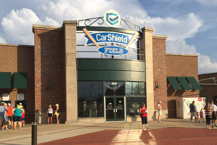
O’Fallon Hoots at CarShield Field

Summer baseball, tournaments, and community events at the city stadium. Review the current schedule, ticketing, and parking.

2650 Tri Sports Circle

Renaud Center

A municipal recreation complex with aquatics, fitness, gymnasium space, programs, and a public art gallery.

Local services and institutions

Who serves O’Fallon

MUNICIPAL GOVERNMENT

City of O’Fallon

  • Municipal Centre · 100 North Main Street · 636-240-2000
  • Administration, police, planning, permits, parks, and environmental services
PUBLIC SCHOOLS

Multiple districts

  • Fort Zumwalt, Wentzville, and Francis Howell may apply
  • Confirm current attendance from the exact address
  • The site provides neutral factual school information
POLICE, FIRE & EMS

City and district public safety

  • O’Fallon Police: 636-240-3200
  • O’Fallon Fire Protection District or another serving district
  • St. Charles County Ambulance District: 636-344-7600
UTILITIES

Multiple territories

  • Ameren Missouri or Cuivre River Electric
  • Spire where available
  • City, Missouri American Water, or PWSD water may apply
  • City or Duckett Creek wastewater may apply
HOA & DEVELOPMENT

Subdivision-specific review

  • Covenants, architectural approvals, and assessments
  • Special tax districts and development phases
  • Drainage, roads, common facilities, and adjacent land use
CONNECTIVITY

I-70 and Route 364

  • Highway K is the primary commercial spine
  • Bryan Road and TR Hughes provide alternatives
  • Commute varies materially by side of the city

School attendance, emergency-response district, utility territory, and jurisdiction may vary within a mailing area. Confirm the organizations serving a specific property by address.

Buyer due diligence

Four O’Fallon details worth resolving before closing

School district boundaries

Fort Zumwalt, Wentzville, and Francis Howell assignments occur within O’Fallon addresses.

What to do: Confirm current attendance and transportation directly from the exact address; do not rely on listing fields.

HOA and special-tax obligations

Many planned communities have covenants, assessments, architectural review, or special district taxes.

What to do: Review governing documents, budgets, reserves, violations, pending assessments, and the complete tax bill.

Highway K and interchange traffic

Commercial traffic and signal queues vary by time and corridor.

What to do: Test the actual commute during peak periods and identify realistic alternate routes.

Drainage and development phase

Creek tributaries, grading, detention areas, rear-yard swales, and continuing construction can affect individual lots.

What to do: Review plats and drainage easements, inspect after rain, and check current development approvals nearby.

Related communities

Compare other places in St. Charles County

Common questions

O’Fallon questions buyers commonly ask

Is every O’Fallon mailing address inside the same jurisdiction?

Not necessarily. Postal names can extend beyond city limits, so city and county responsibilities may differ by parcel.

How long is the drive to downtown St. Louis?

Use roughly 35–50 minutes as a general orientation. The exact starting point, destination, traffic, and local-road portion determine the actual trip.

Which school district serves the area?

Fort Zumwalt; Wentzville. Attendance boundaries can split a mailing area, so the property address controls the assignment.

What housing is common?

Large subdivisions, townhomes, apartments, established neighborhoods, and extensive new construction.

What local tradeoffs matter most?

The city is large enough that commute and daily life vary sharply by side HOAs, special districts, school boundaries, and construction phase differ by address

References
City of O’Fallon, MissouriU.S. Census Bureau data for O’Fallon, MissouriFort Zumwalt School DistrictWentzville School DistrictFrancis Howell School DistrictO’Fallon HootsO’Fallon Parks and RecreationSt. Charles County governmentU.S. Census BureauRegional visitor and local-business directoryMissouri DESE directoryFCC National Broadband Map
Talk to Kyle

Thinking about making a move?

Start with the question you have today. No pressure and no generic sales pitch.

Prefer to talk now?